Integration
Subprojects that fall under the Theme 'Integration'.
Geo-information applications (Subproject 3a)
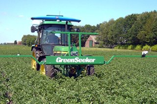
In this project the use of geo-information of soils and crops for precision farming and variable rate application (VRA) technology is investigated. The focus is on integration of sensor data using decision support systems (DSS) and advanced technology (ICT and hardware). Specific questions that will be addressed are: what components are needed to achieve cost-effective VRA of soil pesticides and fertilizers, how accurate are the available geo-data and how do prototypes of this technology perform? Furthermore, better use of weather information in VRA technology will be explored and what advice-Apps can be developed with existing geo-data.
Project partners: Agrifirm Plant B.V., Agrometius B.V., Bayer Cropscience SA-NV, Kverneland Group Nieuw-Vennep B.V., Wageningen University & Research.
Coordinating research institute: Wageningen University & Research: Corné Kempenaar (trekker) en Thomas Been (trekker).
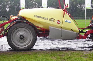
Optimizing variable rate application sprayers with real-time sensor data and external services (Subproject 3b)
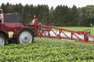
The possibilities of using real-time data of soil, crop and climate in more precision application of pesticides and fertilizers is explored. The aim is to improve the usability and effectiveness of sprayers by automated adaptation of the settings to local conditions. Access to real-time weather, crop, soil and pesticide or fertilizer information from sensors and / or external services is needed. This requires decision support systems (DSS) to translate real-time data into location-specific optimized control of spraying. The ultimate goal is the development and validation of a variable rate application prototype.
Project partners: Kverneland Group Nieuw-Vennep B.V., Agrometius B.V., Wageningen University & Research.
Coordinating research institute: Wageningen University & Research: Corné Kempenaar (trekker), Jan van de Zande en Jean-Marie Michielsen.
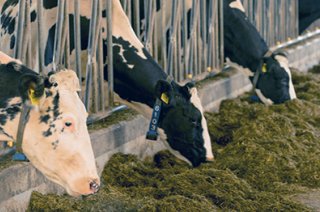
Sensor-controlled yield prediction for grass and maize (Subproject 3c)
Over the last decades little development was made regarding the use of site-specific field data for precision farming in forage production. Since the milk quotas are abolished in 2015 the dairy sector is expected to grow strongly. Therefore, the forage production has yet to become more efficient in order to maintain self-sufficient. This project focuses on developing knowledge about real-time data from sensors and decision support (i.e. crop growth models) to achieve more accurate yield predictions. The aim is to determine how crop yield of pastures can be estimated and how the spatial distribution within a field-plot can be visualized.
Project partners: ZLTO, Agrifirm Plant B.V., Kverneland Group Nieuw-Vennep B.V., Wageningen University & Research.
Coordinating research institute: Wageningen University & Research: Idse Hoving (trekker), Marleen Riemens en Thomas Been.
This part of the project will be executed in cooperation with the project Amazing Grazing. You can read here the latest news items about predicting grass growth.
Also have a look at this YouTube video "Blij met sensoren in de wei" ('Happy with sensors in the field') in which video is explained and demonstrated how sensors can be used to predict for example the biomass production of a pasture.
- Unfortunately, your cookie settings do not allow videos to be displayed. - check your settings
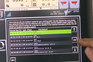
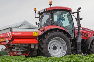
Online fertilizer application advice (Subproject 3d)
The aim of this subproject is to develop an online fertilizer application advice based on new knowledge and combining recent databases and ICT. It is being studied how to improve fertilizer application advices by using real-time data of soil, crop and climate conditions. The focus is on top dressing nitrogen fertilization of potatoes and wheat during the season. The proposed on-line advice system will provide task maps for variable top dressing (VRA) of nitrogen.
Project partners: Agrifirm Plant B.V., Wageningen University & Research.
Coordinating research institute: Wageningen University & Research: Frits van Evert en Thomas Been (trekker).
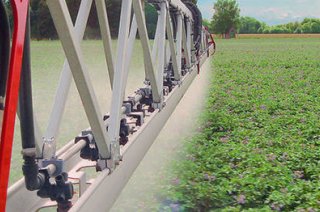
The process of flying, calculating a N sidedress advice and the application of the fertilizer amount for potato is illustrated below in Figures 1 - 4.
 that was measured on a field with starch potatoes on 13 June 2017. It concerns a field on sedimentary soil where potatoes from the Axion variety were planted on 10 April.")


References
- Vos, J. Split nitrogen application in potato: effects on accumulation of nitrogen and dry matter in the crop and on the soil nitrogen budget. Journal Of Agricultural Science 133, 263-274 (1999).
- Van Evert, F. K. et al. Using crop reflectance to determine sidedress N rate in potato saves N and maintains yield. European Journal of Agronomy 43, 58-67, doi:10.1016/j.eja.2012.05.005 (2012).